This independently written summary is based on a manufacturer-reported project published by PQWT. The project outcome is attributed to that source; geology, pipe conditions and operator technique vary, so this case is not a performance guarantee.
Manufacturer case material published December 18, 2025: Successful Water Source Detection in Zambia Using PQWT M100 – Case StudyProject context in a water-constrained area
The source places the project in a remote Zambian setting where households and farms depended on rainfall and shallow water sources. Earlier drilling decisions were described as uncertain because aquifers were unevenly distributed and local geological conditions varied across the site.
The practical objective was not merely to display a profile. It was to reduce the area of uncertainty before committing drilling resources and to choose a target that could support domestic and agricultural demand. That makes local well information, terrain and a repeatable survey layout especially important.
How the manufacturer says the M100 survey was carried out
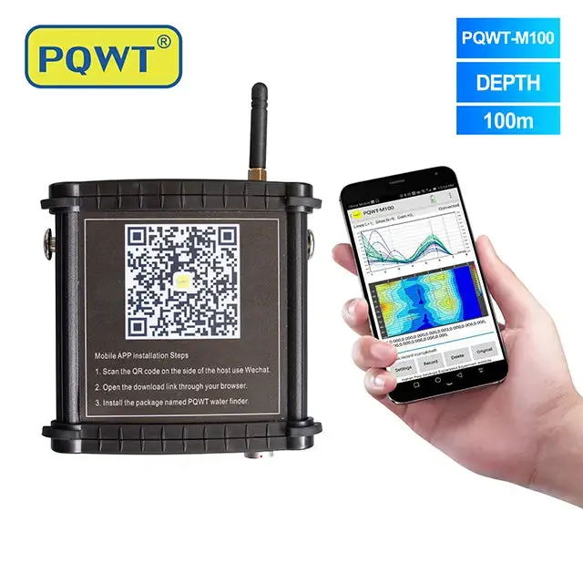
According to the source, the team first considered terrain and local geology, then planned multiple measurement points. The PQWT-M100 was linked with a smartphone so the collected field response could be displayed as subsurface curves or images for comparison along the survey area.
The report describes changes in subsurface electrical properties being used to identify potential structural and water-bearing anomalies at different interpreted depths. Technicians then compared the candidate zones with the project's water demand and drilling requirements before recommending a drilling point and depth range.
Plan the survey area
Use terrain, access, possible structures and any nearby well evidence to choose line direction and station spacing.
Collect multiple points
Keep spacing and operating procedure consistent so neighboring values can be compared meaningfully.
Review repeatability
Recheck isolated anomalies and use a second line where possible instead of selecting one extreme value.
Rank a drilling target
Combine the profile with hydrogeology, drilling capacity and the intended water use.
Verify after drilling
Record formations, water strikes, final depth, water level, pumping response and quality results.
The drilling outcome reported by the source
The manufacturer states that drilling proceeded at the selected location without repeated trial holes and that the completed well produced a stable water supply for local domestic and agricultural use. The source presents the result as a successful field application of the mobile detector.
That outcome should be read as one reported project rather than a guaranteed success rate. A reliable technical record would also include the final borehole depth, geological log, static and pumping water levels, measured discharge, test duration, recovery and water quality. Those data allow a future customer to compare the case with a new site.
How to apply the case to another African groundwater project
- Collect nearby well depths, yields, dry-hole records and seasonal water levels before designing the lines.
- Choose an investigation range around plausible target depths, not simply the deepest available model.
- Run survey lines across expected structures and include background on both sides of the target area.
- Mark power lines, fences, buried utilities, pumps and other interference before measuring.
- Use repeat lines or cross-lines to test the preferred anomaly.
- Budget for borehole logging, well development, pumping tests and water-quality analysis after drilling.
Practical lessons from the reported project
Mobile display helps field review
Smartphone-linked profiles can make point-to-point comparison easier, but the visual output still needs geological interpretation.
Multiple points matter
A line of consistent measurements is more useful than one isolated reading because shape and repeatability can be tested.
Drilling remains the verification
A successful water strike, pumping response and water-quality result—not the screen image—determine whether the project meets demand.
Document the outcome
Future decisions improve when coordinates, logs, depths, yield and seasonal performance are preserved with the profile.
Related equipment
Frequently asked questions
Did the M100 directly prove the amount of water in Zambia?+
No. The source reports that the survey helped select a drilling point and that the completed well supplied water. A detector does not directly measure sustainable yield before drilling.
Does this case guarantee the same result at another site?+
No. Geology, recharge, field layout, interference, drilling and well construction differ. Treat the case as a workflow example, not a performance guarantee.
What records should a similar project collect?+
Keep coordinates, line direction, station spacing, raw data, profiles, field notes, drilling logs, water strikes, static level, pumping-test results and water quality.
Is a 100 m model suitable for every Zambian project?+
No. Model range should follow local geology, expected target depth and drilling capacity. Deeper targets may require another survey configuration or complementary method.
PROJECT REVIEW & MODEL SELECTION
Planning a groundwater survey in Africa?
Send the country, terrain, target depth, intended water use and nearby well information. We can help compare the M100 with deeper mobile and portable models and outline the field data needed.