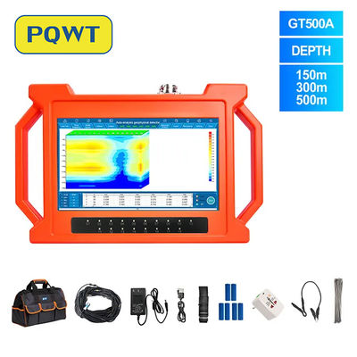
Natural electric fields are scientifically real, but that does not automatically prove the accuracy of a specific groundwater detector. PQWT's public descriptions refer to “natural electric field frequency selection,” while some marketing pages also describe transmitting signals. A credible evaluation therefore requires more detail: exactly what is measured, which sensors and channels are used, how long data are recorded, how noise is removed, how depth is calculated, what inversion is performed and how results compare with blinded drilling or borehole data.
Online discussions often reduce the question to two extremes: either a device is a revolutionary water finder or it is “snake oil.” Neither label is a substitute for testing. The scientifically useful question is narrower: Does the instrument make stable, reproducible measurements, and do its interpretations predict subsurface conditions better than chance or local geological judgment alone?
This article separates three issues that are frequently mixed together: whether the physical phenomenon exists, whether the instrument measures it correctly and whether the software interpretation is accurate enough to support a drilling decision.
Why geologists and geophysicists are skeptical
Skepticism is understandable when a device claims to estimate aquifer location or depth quickly but its public documentation does not give enough information for another geophysicist to reproduce the result. The main concerns are methodological, not merely reputational.
Ambiguous terminology
“Natural electric field” could refer to self-potential, telluric electric fields, audio-magnetotellurics or another implementation. These methods use different sensors, field procedures and processing.
Incomplete acquisition details
A technical description should state electrode geometry, electric and magnetic components, frequency range, sampling rate, station duration, channel synchronization and contact-resistance controls.
Opaque processing
Automatic colored profiles may look convincing, but reliability depends on filtering, calibration, forward modeling, inversion assumptions, regularization and sensitivity—not the image alone.
Depth and speed claims
Greater depth normally requires lower-frequency information, adequate signal-to-noise ratio and survey geometry capable of resolving the target. Fast acquisition is not impossible, but it needs site-specific evidence.
Missing uncertainty
A single depth or “water point” without error bars, alternative interpretations or depth-of-investigation analysis can create false confidence.
Success stories without full outcomes
Useful validation must include dry holes, false positives, negative surveys, site selection rules and complete denominators—not only successful wells.
Natural electric fields are real—but interpretation is difficult
The physical premise is not automatically unscientific. The U.S. Geological Survey describes magnetotellurics (MT) as a passive method that records natural electric and magnetic field variations to investigate subsurface resistivity. The U.S. Environmental Protection Agency describes self-potential (SP) as naturally occurring voltage generated by subsurface current flow, including electrokinetic and electrochemical processes involving groundwater or pore fluids.
The difficulty is that these signals are not unique to potable groundwater. Rock type, porosity, fractures, clay, salinity, mineralization, temperature, cultural electrical noise and fluid movement may all affect electrical observations. The inverse problem is also non-unique: more than one subsurface model can explain the same surface data.
Comparison with established groundwater geophysical methods
| Method | What is measured | Water sensitivity | Main limitations |
|---|---|---|---|
| VES / Electrical Resistivity | Injected current and measured voltage at grounded electrodes | Indirect; estimates apparent resistivity related to saturation, pore water and geology | Clay, saline water and lithology can mimic water-bearing zones; 1D assumptions may fail |
| ERT | Many resistivity measurements across an electrode array | Indirect; images lateral and vertical resistivity variation | Needs substantial field layout, good ground contact and careful inversion |
| TEM / TDEM | Time-decay response after a transmitted electromagnetic field is switched off | Indirect; maps electrical conductivity with depth | Cultural noise, conductive overburden and equivalence can limit interpretation |
| MT / AMT | Natural electric and magnetic field time series and their impedance relationship | Indirect; resolves subsurface resistivity over large depth ranges | Requires appropriate sensors, recording time, processing, dimensional analysis and inversion |
| Self-Potential | Naturally occurring voltage differences at the ground surface | Can respond to groundwater flow and electrochemical processes | Signals have multiple causes; quantitative interpretation is underdetermined without added information |
| Surface NMR / MRS | Magnetic resonance response of hydrogen nuclei in liquid water | More direct sensitivity to liquid water content | Low signal-to-noise ratio, electromagnetic noise, loop logistics and practical depth limits |
Even established electrical and electromagnetic methods generally infer groundwater from physical properties rather than “seeing” water directly. They are most useful when integrated with geological mapping, nearby well logs, hydrogeology and drilling.
How should PQWT “natural electric field” claims be assessed?
PQWT's public material states that its groundwater instruments analyze frequency components of natural electric-field signals and use differences in electrical properties to map anomalies. Another public explanation also refers to transmitting signals. Those descriptions may represent different models or simplified marketing language, but the difference between passive measurement and an active source is technically important and should be clarified in model-specific documentation.
A scientific evaluation should not begin or end with the brand name. For each model, ask whether the documentation identifies:
- The measured physical quantity and units, rather than only a color profile.
- Electrode or sensor type, geometry, channel count and synchronization.
- Whether the source is passive, active or a combination, and the exact frequency range.
- Recording time per station, stacking, filtering and rejection of power-line or cultural noise.
- The forward model and inversion method used to convert data into depth.
- Resolution, sensitivity, uncertainty and realistic depth-of-investigation limits.
- Raw-data export and enough information for independent reprocessing.
If these details are unavailable, the correct conclusion is not that every reading must be false. It is that strong accuracy and depth claims remain difficult to evaluate independently.
A fair field test for any groundwater detector
The strongest way to move beyond online debate is a preregistered, blinded comparison. The same framework can test PQWT, ERT, VES, TEM, MT or any other workflow.
Choose representative sites
Include volcanic, fractured-bedrock, alluvial, sedimentary and clay-rich settings if the instrument is marketed for all of them.
Hide the ground truth
Use sites with reliable borehole logs, but do not reveal well locations, depths or outcomes to the operator before predictions are recorded.
Define success in advance
Specify tolerances for target position, depth interval, saturated-zone identification and false-positive rate before seeing the results.
Repeat and cross-check
Repeat lines on different days and, where possible, use an independent method such as ERT, VES or TEM with a separate operator.
Report every outcome
Publish correct predictions, misses, dry holes, false positives, unusable data and excluded sites with reasons.
Compare against baselines
Measure whether the detector improves decisions beyond geological mapping, nearby well records and experienced local siting alone.
Reports that only show a successful drilling photo cannot establish sensitivity, specificity or predictive value. A credible validation dataset needs both successes and failures.
Groundwater detector buyer checklist
Can it be exported?
Ask for original readings, units, metadata and a worked example from acquisition through interpretation.
Does the anomaly persist?
Request repeated lines, reverse-direction lines and results from different operators or days.
What else could explain it?
Look for error estimates, alternative models, interference checks and depth-of-investigation limits.
Where is the full record?
Ask for borehole logs and drilling outcomes that include misses and dry holes, not only selected successes.
- Do not buy only on maximum advertised depth.
- Do not treat an automatic profile as a direct image of an aquifer.
- Do not accept guaranteed water depth, yield or water quality before drilling and testing.
- Budget for training, repeat lines, local geology review and independent confirmation on high-cost wells.
- For critical projects, ask a qualified geophysicist or hydrogeologist to review the survey design and interpretation.
Use groundwater detectors as reconnaissance tools—not guarantees
PQWT measurements should support site selection alongside geology, well records and repeat surveys. Drilling, logging and pumping tests remain the final verification of water depth, yield and quality.
Conclusion: skepticism is a reason to demand evidence
The most defensible conclusion is neither automatic endorsement nor automatic dismissal. Natural electric and electromagnetic fields are part of legitimate geophysics. At the same time, reliable groundwater interpretation requires transparent measurement, reproducible processing, geological context, uncertainty analysis and independent ground truth.
Buyers should judge a PQWT detector—or any competing instrument—by the quality of its technical disclosure and blinded field performance. If a model cannot provide enough information to reproduce or independently test its claims, use its results cautiously and confirm important drilling decisions with established methods and qualified professionals.
Frequently asked questions
Is the natural electric field a real geophysical phenomenon?+
Yes. Magnetotelluric and self-potential methods measure naturally occurring electric or electromagnetic fields. The existence of those fields does not, by itself, validate every commercial instrument or every claim made from them. Reliability depends on acquisition design, sensors, calibration, processing, inversion, uncertainty analysis and field validation.
Does a low-resistivity anomaly prove that groundwater is present?+
No. Water saturation can reduce resistivity, but clay, salinity, mineralization, porosity, fractures and cultural interference can produce similar responses. Geological context and independent evidence are needed, and drilling is the final verification.
Is a PQWT detector the same as dowsing?+
It should not be classified only by appearance or marketing language. An instrument that records reproducible electrical measurements is different from a dowsing rod. However, its interpretations still require transparent methods, repeatable data and controlled validation before strong claims about depth, aquifers or drilling success can be accepted.
Can any groundwater detector guarantee a successful well?+
No. Geophysical surveys reduce uncertainty; they do not eliminate it. Well success, yield and water quality also depend on geology, recharge, fracture connectivity, drilling construction and testing.
What evidence should a buyer request?+
Ask for raw-data examples, sensor and channel specifications, station duration, calibration procedures, interference controls, processing and inversion descriptions, uncertainty estimates, repeatability tests, complete case histories and independent comparisons against borehole logs or drilling results.
Scientific and technical sources
The analysis above uses public descriptions and established geophysical references. These links are provided so readers can examine the methods directly.
- U.S. Geological Survey: Magnetotelluric data and method for aquifer characterization
- U.S. EPA: Electrical Resistivity—basic concept, acquisition and limitations
- U.S. EPA: Self-Potential—natural voltage and hydrogeological applications
- U.S. Geological Survey: Groundwater exploration using the resistivity method
- Sensors: Magnetic resonance sounding as a direct, quantitative groundwater method
ASK BEFORE YOU BUY
Need model specifications or field-test information?
Send the model, geology, target depth and survey location. Ask for method details, raw-data examples, operating guidance and a suitable validation workflow before making a drilling decision.